
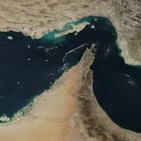
Strait of Hormuz Intelligence Feed
Pricing
from $5.00 / 1,000 results
Strait of Hormuz Intelligence Feed
Scrape Strait of Hormuz vessel positions and add tanker flow, oil chokepoint, and maritime risk signals from public AIS map data and shipping news.
Pricing
from $5.00 / 1,000 results
Rating
0.0
(0)
Developer
wiseld_squid
Maintained by CommunityActor stats
1
Bookmarked
7
Total users
0
Monthly active users
5 months ago
Last modified
Categories
Share
Scrape Strait of Hormuz vessel positions and enrich each result with tanker flow, oil chokepoint, and maritime risk signals.
What This Actor Does
This Actor works like a Hormuz AIS and tanker traffic scraper with extra intelligence fields. It returns vessel rows from the Strait of Hormuz, Gulf of Oman approach, and Persian Gulf approach, then enriches each row with risk score, tanker classification, movement direction, slow/stopped vessel flags, news risk, and a plain-English recommendation.
It answers:
- Which vessels and tankers are currently visible around the Strait of Hormuz?
- Are tankers moving slowly or stopping near the transit corridor?
- Is visible tanker flow inbound, outbound, or mixed?
- Are shipping or geopolitical news signals elevated?
- Should risk teams monitor this chokepoint more closely?
Simple Input
The default settings are ready to run. No AIS API key is required.
Input Fields
includeNewsSignals- Add Hormuz, tanker, and maritime security news signals.includeAIS- Add public AIS/map vessel-density and slow-vessel signals.maxVessels- Maximum vessel rows to save. Default is 100.tankersOnly- Save only tanker-related vessels to the dataset.alertThreshold- Risk score level that triggers an alert.
Output
The Actor returns vessel rows:
- 1 dataset result = 1 vessel
- Each vessel row includes Hormuz risk context, tanker flow signal, risk score, and recommended action.
- The full Markdown intelligence brief is saved separately as
REPORT.md.
Each vessel row can include:
vessel_namemmsiimosource_ship_idvessel_typeis_tankertanker_categorylatitudelongitudespeed_knotscoursedirectionzone_segmentzone_segmentstanker_zone_segmentsdestinationis_slow_vesselis_stopped_or_waitingrisk_scorerisk_leveltanker_flow_signalpressure_signalnews_risk_signalsummaryrecommended_action
It also saves:
REPORT.mdSIGNALS.csv
Sources
- Public AIS/map tile signals for visible vessel positions.
- Google News RSS for Hormuz, tanker, and maritime disruption keywords.
- EIA World Oil Transit Chokepoints for static oil chokepoint context.
- IEA Strait of Hormuz oil security context for strategic importance and LNG exposure.
Zone Segments
The Actor classifies each vessel into one approximate monitoring segment:
hormuz_transit_corridorfujairah_anchoragegulf_of_oman_approachpersian_gulf_approachuae_oman_coastal_stagingouter_monitoring_area
Example Output
If AIS is unavailable, the Actor still saves REPORT.md and SIGNALS.csv with warnings.
Use Cases
- Energy market researchers monitoring oil chokepoint risk
- Maritime risk teams watching tanker movement
- Shipping analysts tracking Gulf of Oman and Persian Gulf traffic
- Insurance and compliance teams monitoring route exposure
- Newsletter writers creating maritime risk briefs
- Supply-chain risk platforms needing structured chokepoint signals
Notes
- Public AIS/map signals can be delayed, incomplete, or unavailable.
- EIA/IEA context is static reference context, not live flow volume.
- Vessel and news signals can change between runs.
- Each dataset result is normally one vessel row.
- Free preview runs are limited to 10 vessel rows.
- Pricing works naturally as results-based usage because vessel rows are the main dataset output.
- If a live source is unavailable, the Actor continues with the remaining sources and adds a warning.
- This Actor provides public-source risk signals, not official security, logistics, or financial advice.


