Google Street View Panorama Scraper
Pricing
from $0.05 / panorama (low res)
Google Street View Panorama Scraper
Fetches Google Street View tiles for a location and stitches them into a single panorama image. No API key required!
Pricing
from $0.05 / panorama (low res)
Rating
5.0
(2)
Developer
Jindřich Bär
Maintained by CommunityActor stats
0
Bookmarked
9
Total users
3
Monthly active users
3 months ago
Last modified
Categories
Share
Street View Panorama Scraper
An Apify actor that fetches Google Street View tiles for a given coordinate, stitches them into a single equirectangular panorama (JPEG), and stores the image plus its address metadata.
Both official Google Street View imagery and user-contributed photo spheres are supported. Photo spheres often have a smaller native resolution than full Google panoramas, so the actor reads each panorama's imageWidth/imageHeight from metadata and computes the per-panorama max zoom — the requested q is clamped down accordingly so the output is always a complete image.
Example
| Image | Location | Latitude | Longitude |
|---|---|---|---|
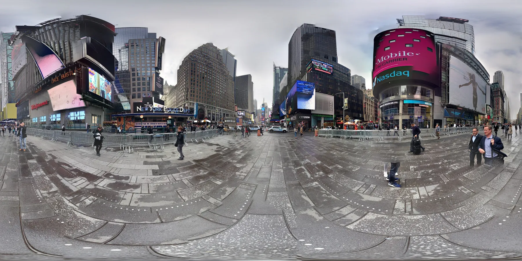 | 1560, Broadway, Manhattan, New York, New York County, United States, 10036 | 40.75846516956224 | -73.98532660198624 |
Input
| Field | Type | Required | Default | Description |
|---|---|---|---|---|
lat | number | yes | — | Latitude in decimal degrees, range -90–90, e.g. 50.0696892. |
lon | number | yes | — | Longitude in decimal degrees, range -180–180, e.g. 14.4487853. |
q | integer | no | 3 | Tile zoom level, 0–5. Higher = more tiles fetched (~4× per step). Capped at the panorama's own native max zoom. |
Example:
Quality levels
The exact tile count depends on the panorama's native resolution. For a standard Google panorama (16384×8192 px):
q | Tile grid (max) | Output size (max) |
|---|---|---|
| 0 | 1×1 | 512×512 px |
| 1 | 2×1 | 1024×512 px |
| 2 | 4×2 | 2048×1024 px |
| 3 | 8×4 | 4096×2048 px |
| 4 | 16×8 | 8192×4096 px |
User-contributed photo spheres are typically smaller and will be returned at their native resolution if q exceeds it.
Output
Key-value store
The stitched panorama is stored as streetview_<panoId>_z<q>.jpg.
Dataset One row per run, with the following fields:
| Field | Type | Description |
|---|---|---|
imageUrl | string | Public URL of the panorama JPEG in the key-value store. |
location | string? | Human-readable address joined from the panorama's address components. |
lat | number | Latitude of the actual panorama (snapped to the nearest pano). |
lon | number | Longitude of the actual panorama (snapped to the nearest pano). |
Example:
Notes
- The metadata search radius is 500 m. If the coordinate is far from any indexed panorama the run fails with
no Street View panorama near this location. - Tiles that 404 (occasionally seen near the seams of partial panoramas) are skipped so the rest of the image still renders.
- Output is a flat equirectangular JPEG; pair it with a panorama viewer (e.g.
pannellum,marzipano) for an interactive 360° experience.